Introduction
Aerial imagery is a powerful tool that allows us to capture detailed and comprehensive visual information from a bird’s eye view. It can provide us with a wide range of useful information such as the layout and topography of an area, the distribution of natural resources, changes in land use, and the impact of human activities on the environment. Aerial imagery can be processed to accurately classify different types of land cover and detect changes over time. This information can be used by city planners to make informed decisions on urban development, land use policies, and environmental management. It can also help researchers to study the impact of urbanization on biodiversity, ecosystem services, and climate change. Aerial imagery is used in various fields, including agriculture, urban planning, environmental studies, and military intelligence, to name a few. It can help us to better understand and manage our natural resources, plan and design infrastructure, and monitor changes over time. With the advances in technology, aerial imagery has become more accessible and affordable, making it an increasingly popular tool for researchers, businesses, and governments.
Results and Conclusion
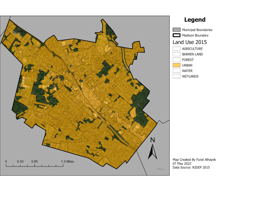
As shown in figure 1. the large majority of Madison is classified as Urban land (80.39%). Although this may overlap with other land uses, it is still important to note. y analyzing changes in land cover over time, a map like this can help us to better understand the impact of urbanization on the environment, plan and design infrastructure, and make informed decisions on land use policies. One relevant fact to consider is that one of the only non-highlighted areas on the map is the Drew forest. As there are current plans to sell this land and urbanize it, Madison would lose one of its only large pieces of non-urbanized land that is used and loved by people and animals alike.
About The Data
Urban Land cover (NJDEP 2016) from the New Jersey Land Use 2015
World Imagery Base layer from the ArcGIS Map Service (ESRI 2009, updated 2023)
