
Red-tailed hawk, status – widespread and common, photography by dklaughman, flickr
Introduction
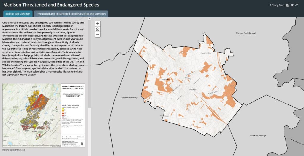
Madison, New Jersey is a highly developed and populous environment with limited space for its threatened and endangered inhabitants. Its limited unmanaged land is mostly preserved woodlands, ponds, and wetlands, which are framed by developed areas. 144 state and federally recognized endangered species habitat sites can be found within Madison.
Data
Madison is split almost evenly between two region classifications: the Piedmont Plains Landscape and the Skylands Landscape. The Piedmont Landscape is characterized by farmed areas, extensive grasslands, fragmented woodlands and productive tidal marshes. The Skylands Landscape contains extensive tracts of contiguous upland and wetland forests that support diverse animal populations. There are five possible rankings for both Landscapes:
Rank 1 – Habitat specific requirements: assigned to species-specific habitat patches that meet habitat-specific suitability requirements such as minimum size or core area criteria for endangered, threatened or special concern wildlife species, but that do not intersect with any confirmed occurrences of such species.
Rank 2 – Special Concern: assigned to species-specific habitat patches containing one or more occurrences of species considered to be species of special concern.
Rank 3 – State Threatened: assigned to species-specific patches containing one or more occurrences of State threatened species.
Rank 4 – State Endangered: assigned to species-specific habitat patches with one or more occurrences of State endangered species.
Rank 5 – Federal Listed: assigned to species-specific habitat patches containing one or more occurrences of wildlife listed as endangered and threatened pursuant to the Federal Endangered Species Act of 1973.
The map above shows threatened and endangered species habitats in Madison, New Jersey. Click the >> button in the top left corner to view the legend.
Results
The Madison Landscape map presented above illustrates the habitats of endangered species in Madison Borough, New Jersey. The red color is the most present which indicates Rank 5: Federal Listed in the five possible rankings for the Piedmont Plains Landscape and the Skylands Landscape. About 502 acres are classified as Rank 5. The second most present color is blue which indicates Rank 1: Habitat specific requirements. About 55 acres are classified as Rank 1. The last color that is present is a green color that indicates Rank 2: Special Concern. This rank is only present in one very small area in Madison, and makes up about 1.23 acres. Of the 2,767 acres of land that make up Madison, 558 of those (or around 20%) are threatened and endangered species habitats.
About the Data
The data utilized in the map is from the NJDEP Bureau of GIS. It was collected as part of the Landscape Project, which was designed to provide users with peer-reviewed, scientifically sound information that transparently documents threatened and endangered species habitat. It was created by combining documented wildlife locations with NJDEP aerial photo-based 2012 Land Use/Land Cover (LULC) to delineate imperiled and special concern species habitat within New Jersey. The Landscape Project maps, available on the NJDEP website, allow the public to anticipate potential environmental regulation. They provide an overlay for proactive planning, such as the development of local habitat protection ordinances, zoning to protect critical wildlife areas, management guidelines for imperiled species conservation on public and private lands, and land acquisition projects. They also help increase predictability for local planners, environmental commissions, and developers and help facilitate local land use decisions that appropriately site and balance development and habitat protection.
A large benefit of the Landscape Project maps is that they help with efficiency. They minimize time and money spent attempting to resolve after-the-fact issues with endangered and threatened species. Many species locations could not be published because they live in nests sites, roost sites, dens, and other sites used by species that are vulnerable to human disturbance and likely to be part of illegal collection. Rather than pinpointing exact locations of the endangered species, Landscape Project maps display habitat patches that animals use and that are required to support local populations.
The differences between endangered, threatened, imperiled, and at-risk species are defined by the United States Geological Survey here. The NJDEP describes the federal Endangered Species Act here.
To download a one-page slide for this summary on threatened and endangered species in Madison, click here.
To learn more about specific species, follow these links:
>> Northern Cricket Frog Habitat
Preserving biodiversity involves not only identifying and protecting threatened and endangered species, but also creating the habitat conditions for a wide variety of species to thrive. To learn more about ecological restoration practices that limit the colonizing effects of invasive species, follow this link:
>> Protecting Biodiversity by addressing invasive species.